Titirangi
Titirangi is a suburb of West Auckland in the Waitākere Ranges local board area of the city of Auckland in northern New Zealand. It is an affluent, residential suburb located 13 kilometres (8 miles) to the southwest of the Auckland city centre, at the southern end of the Waitākere Ranges. In the Māori language "Titirangi" means "long streaks of cloud in the sky", but this is often given as "fringe of heaven".
In the mid-19th century, the Manukau Harbour shoreline was primarily used for kauri logging. In December 1855, John Bishop and Thomas Canty acquired 227 acres of land from John Langford, a land dealer who acquired the area from a Crown grant. Most of the kauri forest was harvested for wood by the early settlers.
The first landowner at Titirangi was John Kelly, who bought 103 acres in 1848. Most of Titirangi and the surrounding area developed as farmland in the 1860s. For communities in the south of Titirangi, most contact to the outside world was through docks along the Manukau Harbour, which linked the settlements to the port of Onehunga. In 1902 at the suggestion of local engineer Henry Atkinson, the wooden precursor to the Upper Nihotupu Dam was constructed, to supply Auckland with a more constant water supply. Atkinson donated land at Titirangi for the project, which involved piping water from the dam to Titirangi, and then on to Auckland City. The dam finished construction in 1923.
Titirangi remained primarily farmland until the advent of World War I, when the number of farm workers in the area plummeted and native plants began to recolonise the area. The Titirangi township greatly developed in the 1910s, because of a need for the laborers working on Scenic Drive (then known as Exhibition Drive) to have lodgings. Exhibition Drive opened on 24 January 1914. In the early 20th century, Wood Bay, French Bay and other Manukau Harbour beaches became popular destinations for Aucklanders.
In 1930, the Hotel Titirangi (now known as Lopdell House) was established as a modern hotel, however the hotel faced difficulties securing a liquor license due to the prohibition of alcohol in West Auckland, and closed less than six months later.
As road access improved in the 1960s, the community became increasingly suburban. Artist Colin McCahon lived at Otitori Bay in Titirangi in the 1950s, during which he painted a number of artworks inspired by the Titirangi landscape.
Map - Titirangi
Map
Country - New_Zealand
 |
 |
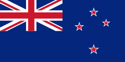
| Flag of New Zealand | |
The islands of New Zealand were the last large habitable land to be settled by humans. Between about 1280 and 1350, Polynesians began to settle in the islands and then developed a distinctive Māori culture. In 1642, the Dutch explorer Abel Tasman became the first European to sight and record New Zealand. In 1840, representatives of the United Kingdom and Māori chiefs signed the Treaty of Waitangi, which in its English version declared British sovereignty over the islands. In 1841, New Zealand became a colony within the British Empire. Subsequently, a series of conflicts between the colonial government and Māori tribes resulted in the alienation and confiscation of large amounts of Māori land. New Zealand became a dominion in 1907; it gained full statutory independence in 1947, retaining the monarch as head of state. Today, the majority of New Zealand's population of 5.1 million is of European descent; the indigenous Māori are the largest minority, followed by Asians and Pacific Islanders. Reflecting this, New Zealand's culture is mainly derived from Māori and early British settlers, with recent broadening of culture arising from increased immigration. The official languages are English, Māori, and New Zealand Sign Language, with the local dialect of English being dominant.
Currency / Language
| ISO | Currency | Symbol | Significant figures |
|---|---|---|---|
| NZD | New Zealand dollar | $ | 2 |
| ISO | Language |
|---|---|
| EN | English language |


